
This urban design studio began with an exploration of the given site, which made up the area near the Roxbury Crossing transit station in the Mission Hill neighborhood of Boston, Massachusetts. The site is comprised mostly of parking lot space owned by Wentworth University, in addition to a Wentworth warehouse, historical industrial buildings, elderly housing, and a mixed-use commercial and residential corner. The site is surrounded by the Mission Main and Alice Taylor low-income housing developments, as well as the Southwest Corridor, a 4-mile linear which reaches downtown.
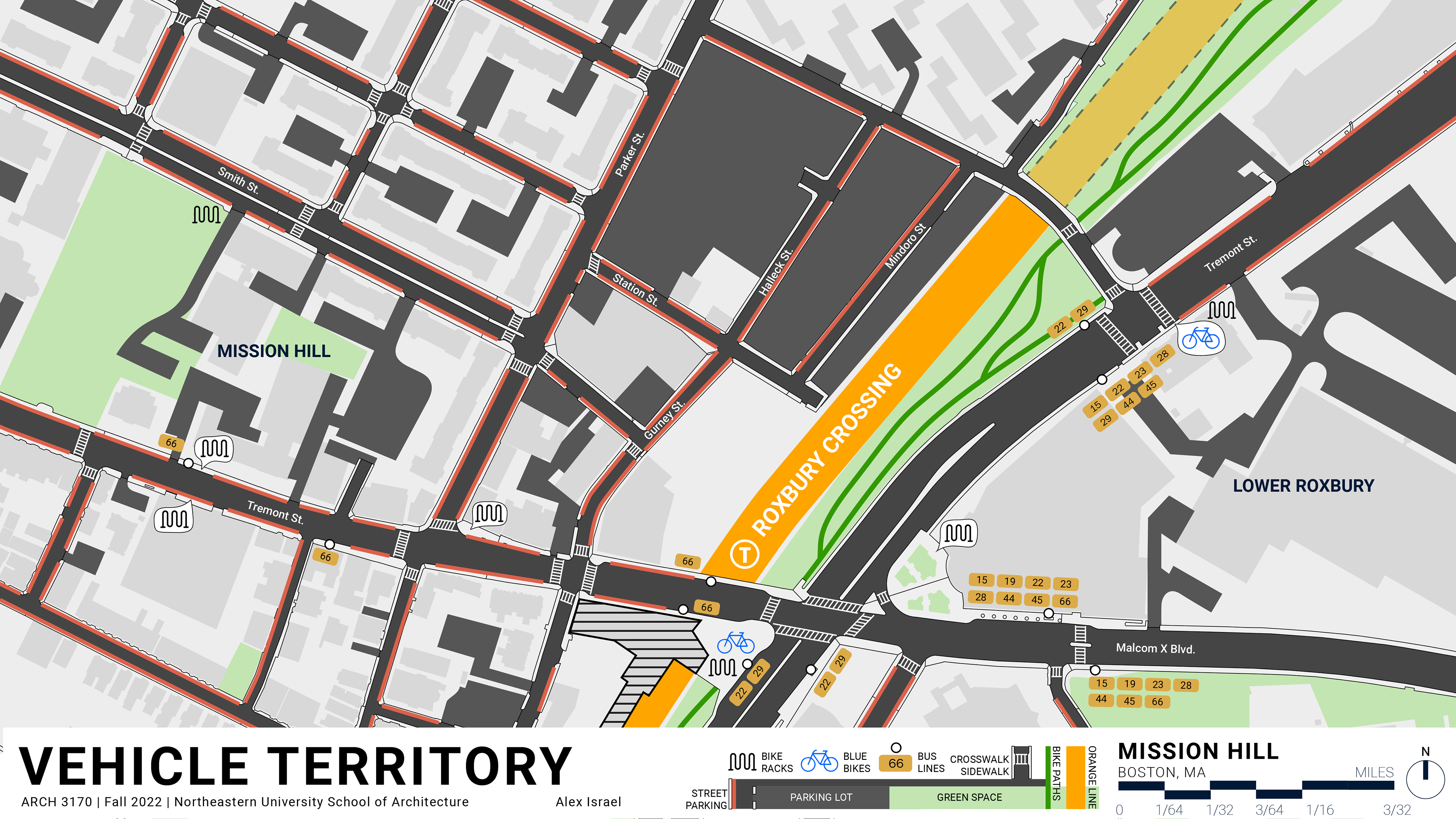
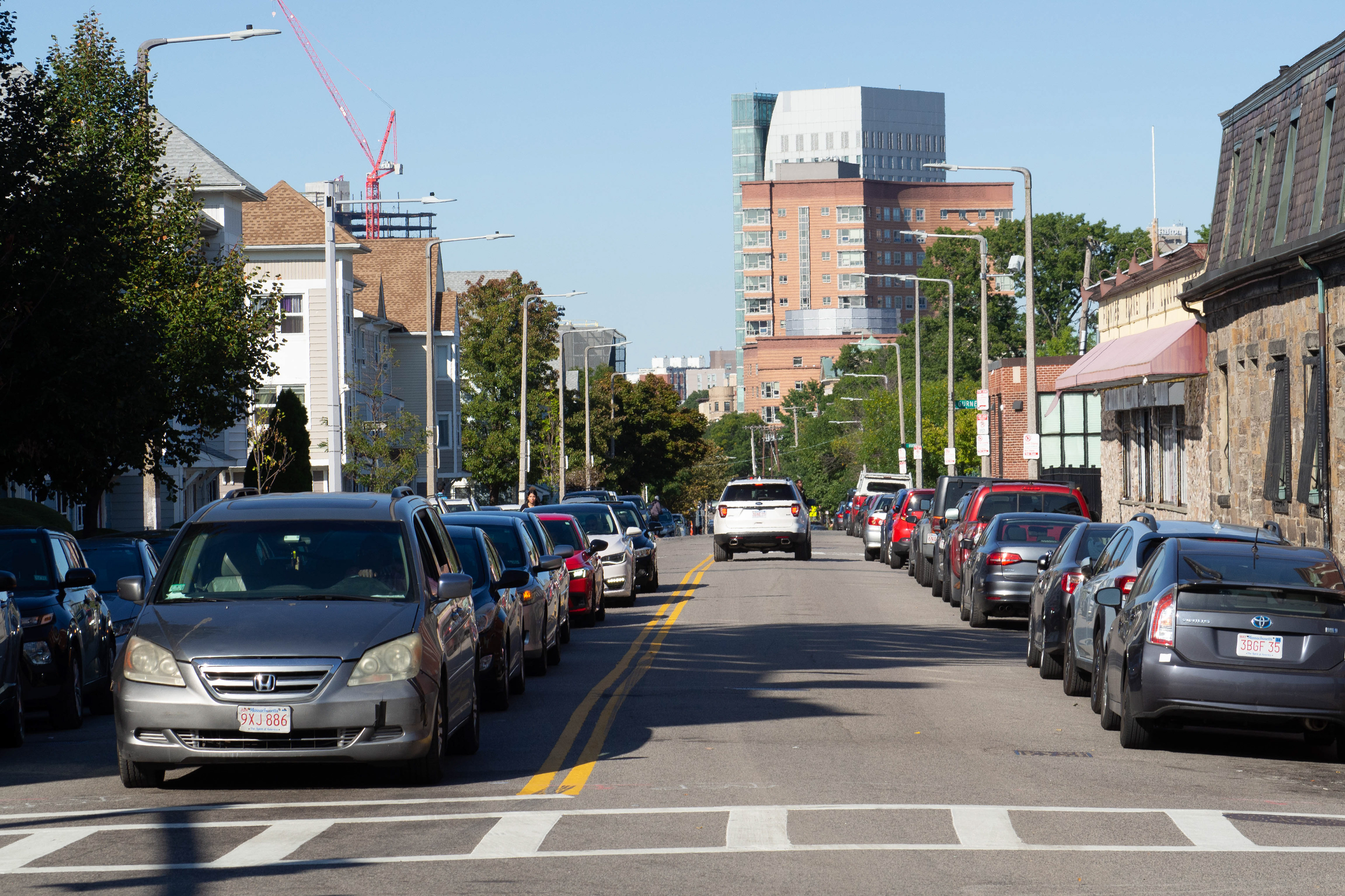
Each student in the class chose a specific topic regarding the site's characteristics to study further. I chose to research the transportation on site, including vehicular access, bus and train lines, walkability and bikeability. Above, I found that paved surfaces take up the majority of the site in the form of roads and parking lots, evidently to serve a car-owning population. However, the surrounding area is mostly made up of lower-income families and college students, whose livelihoods might support a less costly method of transportation. The asphalt landscape, barren and car-infested, makes walking and biking in the area uncomfortable and dangerous.
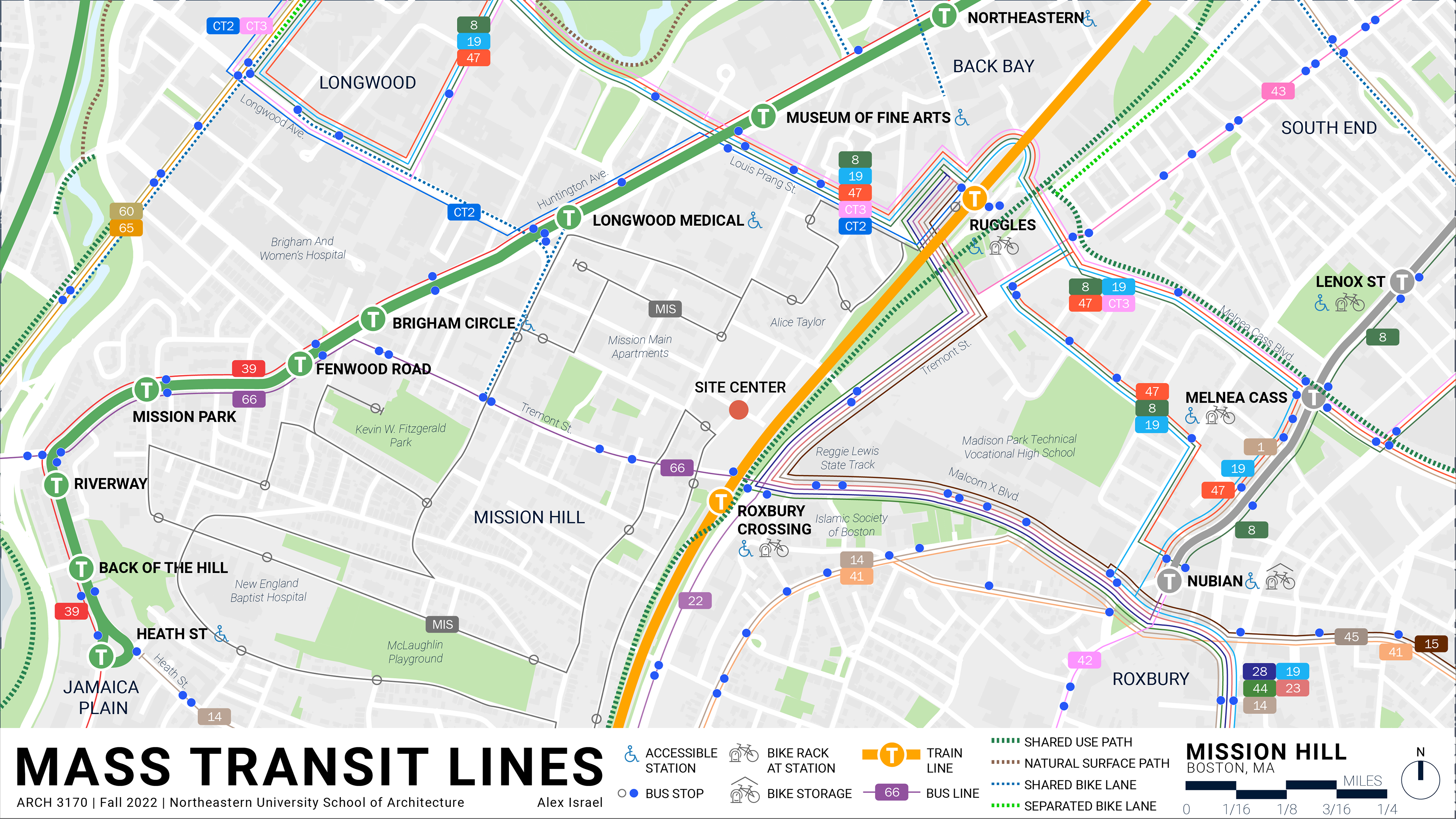
Transit options are plentiful in the area. Roxbury Crossing serves as the transit node, serving the Orange Line from Forest Hills to Oak Grove in addition to numerous bus lines. Mission Hill itself is enclosed on the other side by the Green Line on Huntington Ave, and is serviced by the Mission Hill Link bus, which is a community-run organization designed to assist residents who may need help moving around the Hill.
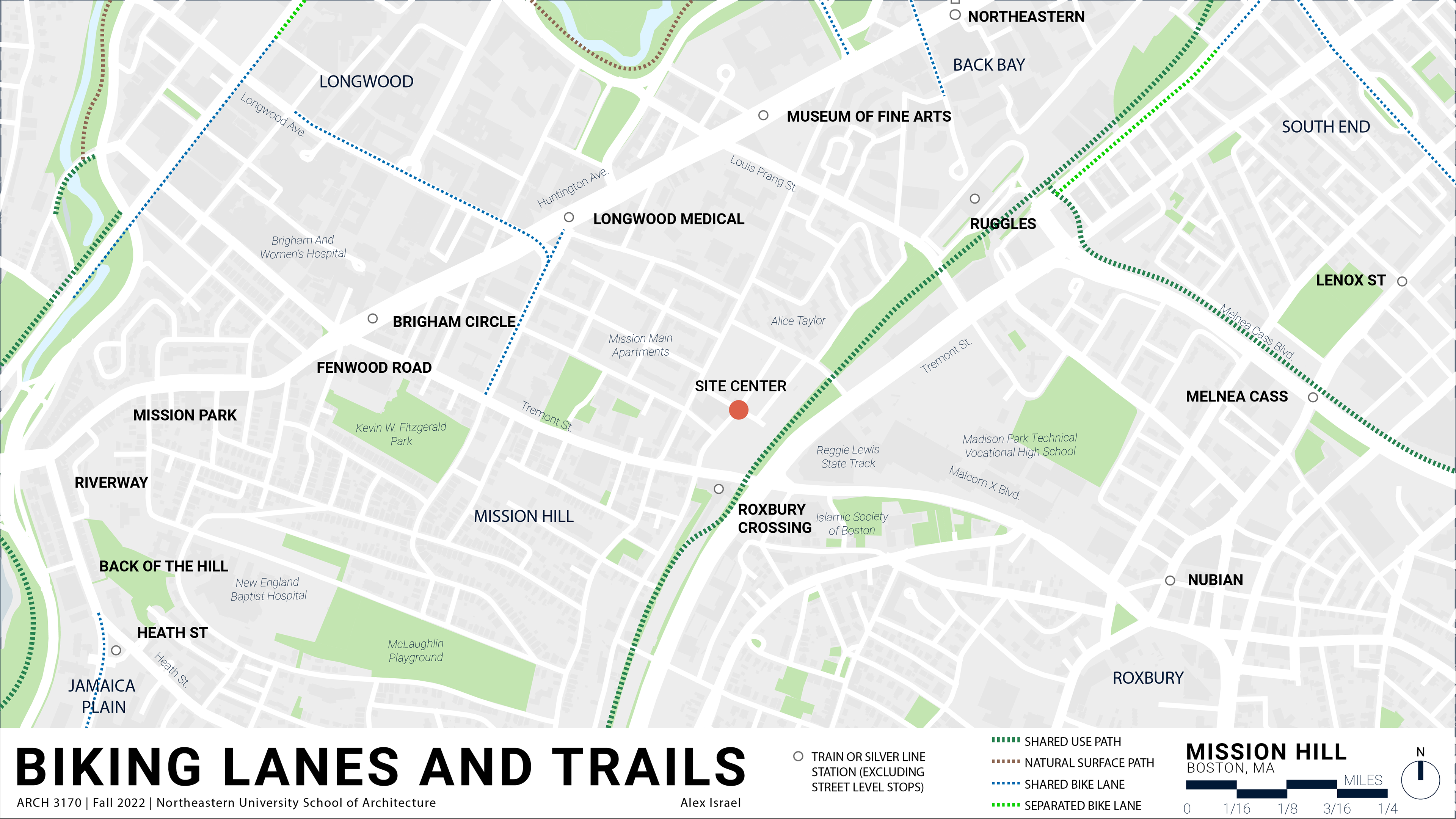
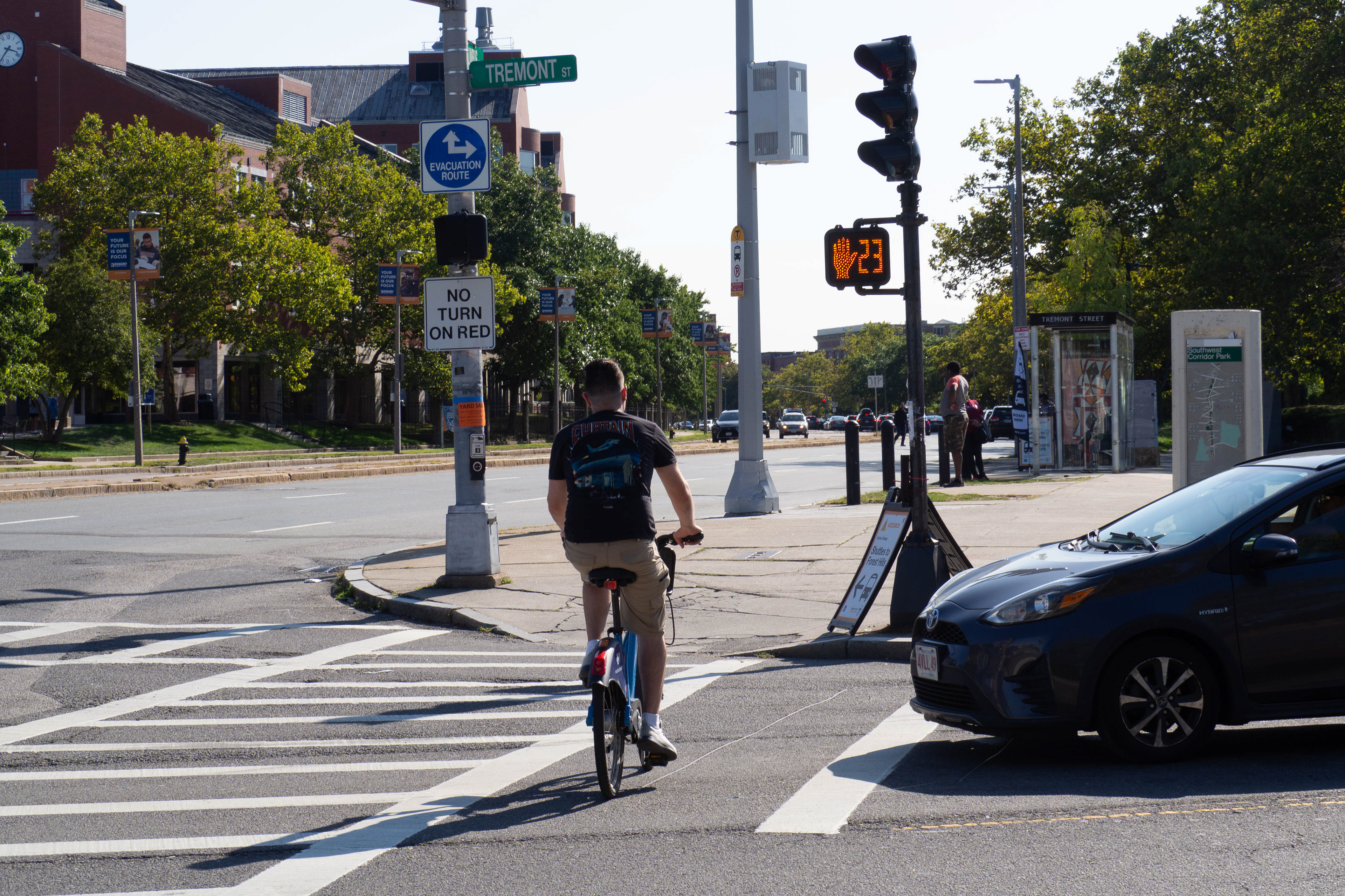
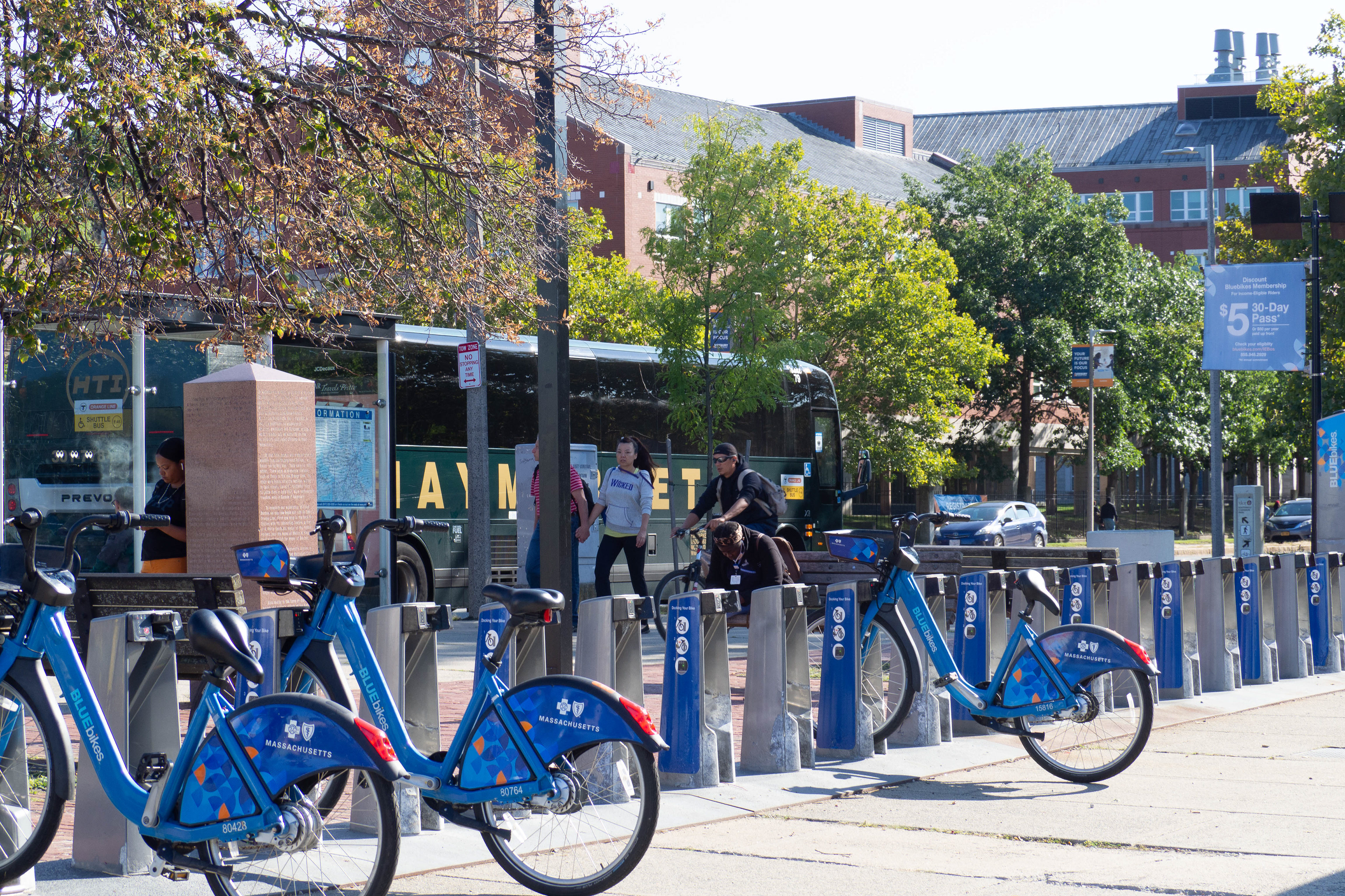
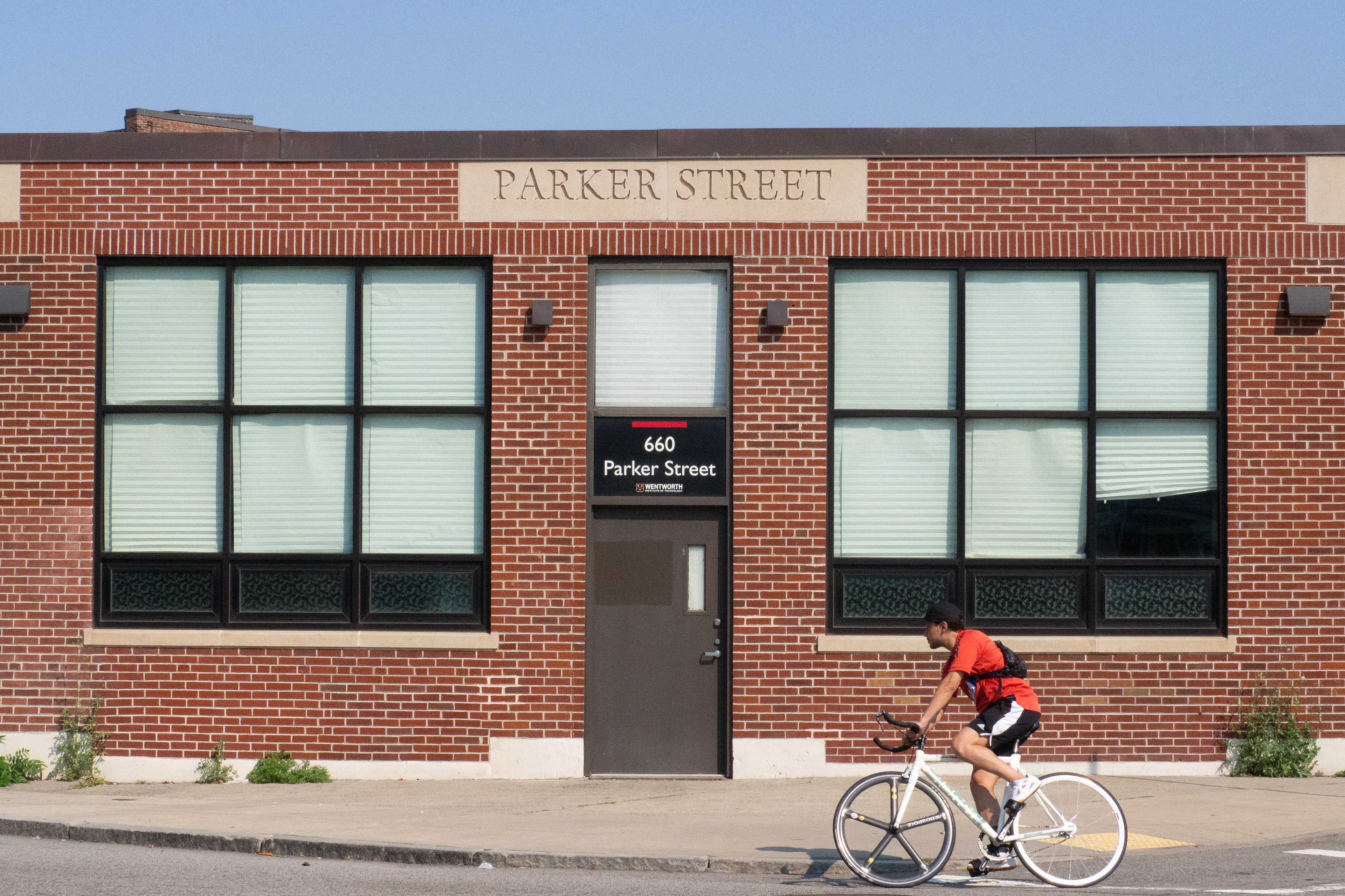
A stark contrast to the transit map, the bicycling map of the area paints a much different picture. Bike lanes are few and far between, with the main cycling spine running along the Southwest Corridor. Most notably, streets missing bike infrastructure include Huntington Avenue, Tremont Street, Malcom X Boulevard, and Parker Street. Roxbury Crossing itself is a bike node, with a Blue Bike station and bike racks, however remains mainly oriented toward vehicular traffic.
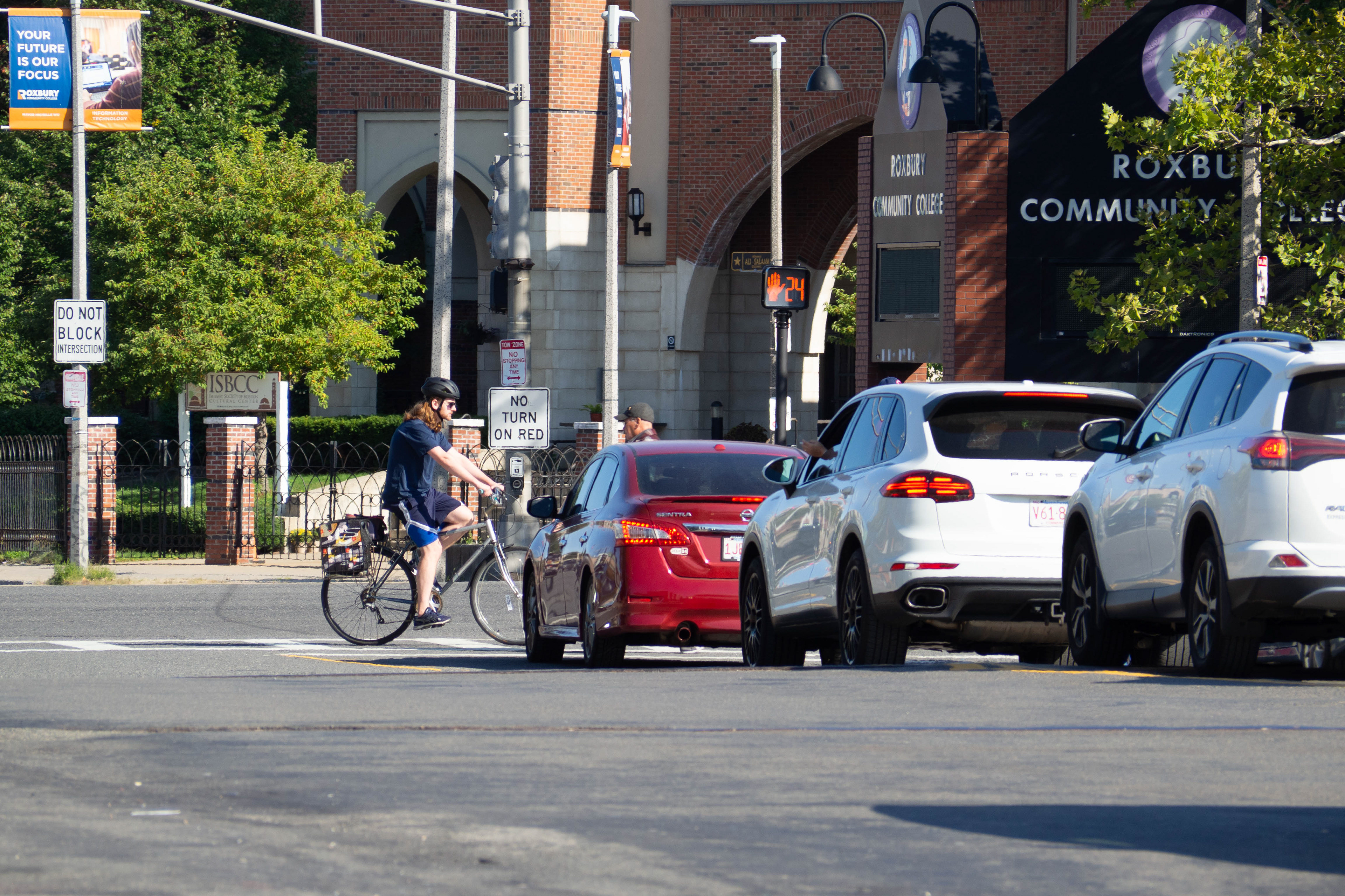
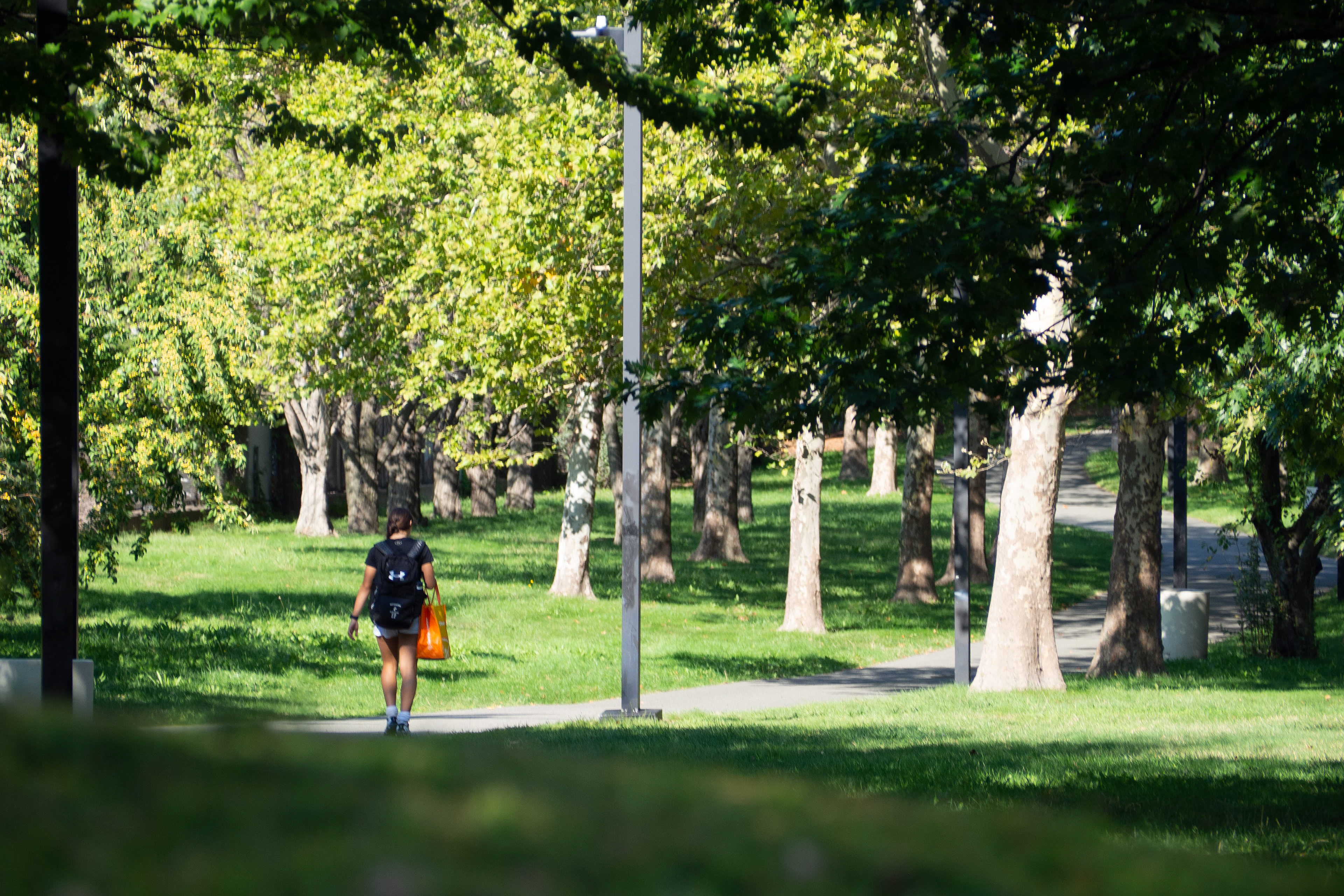
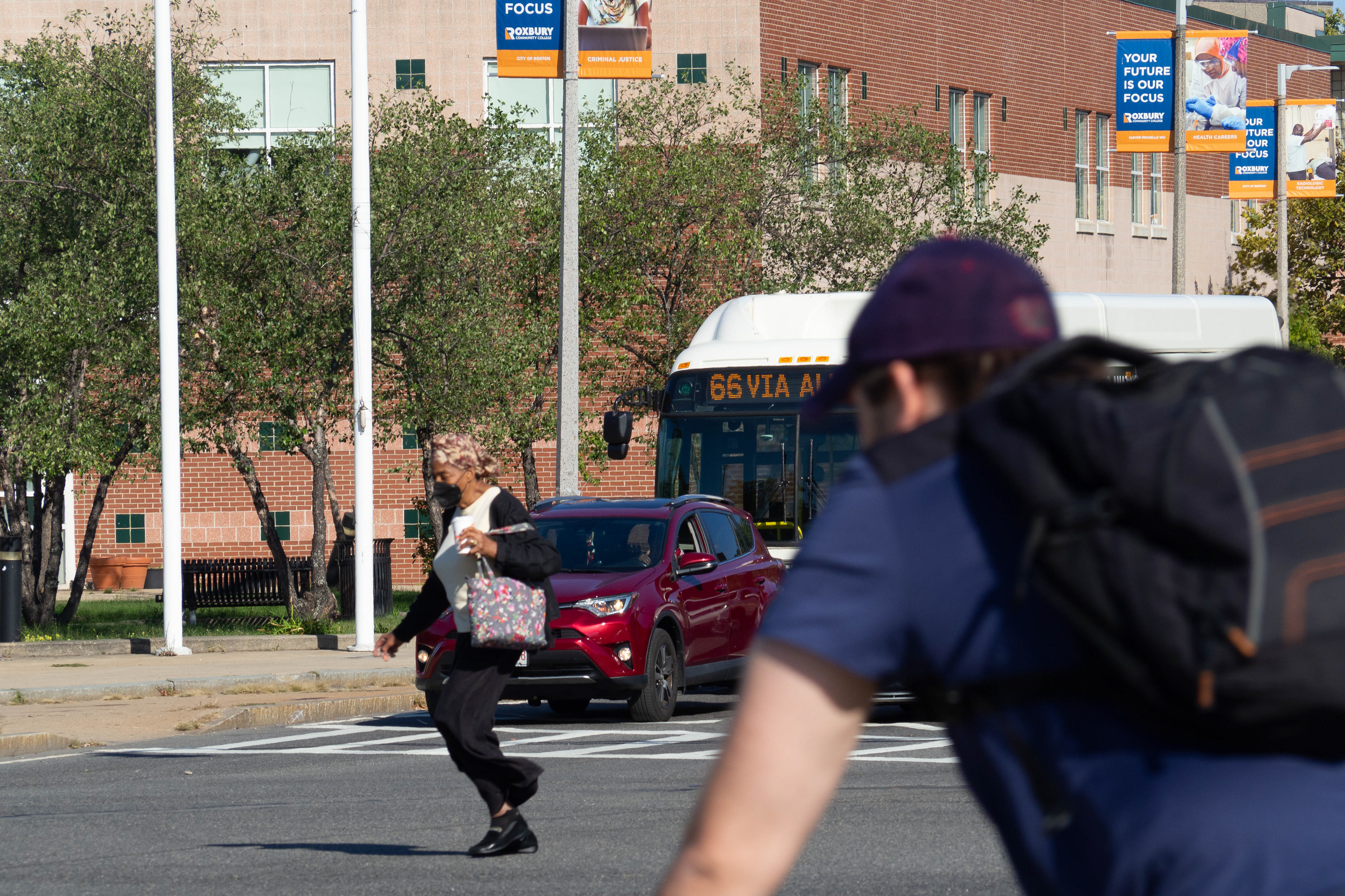
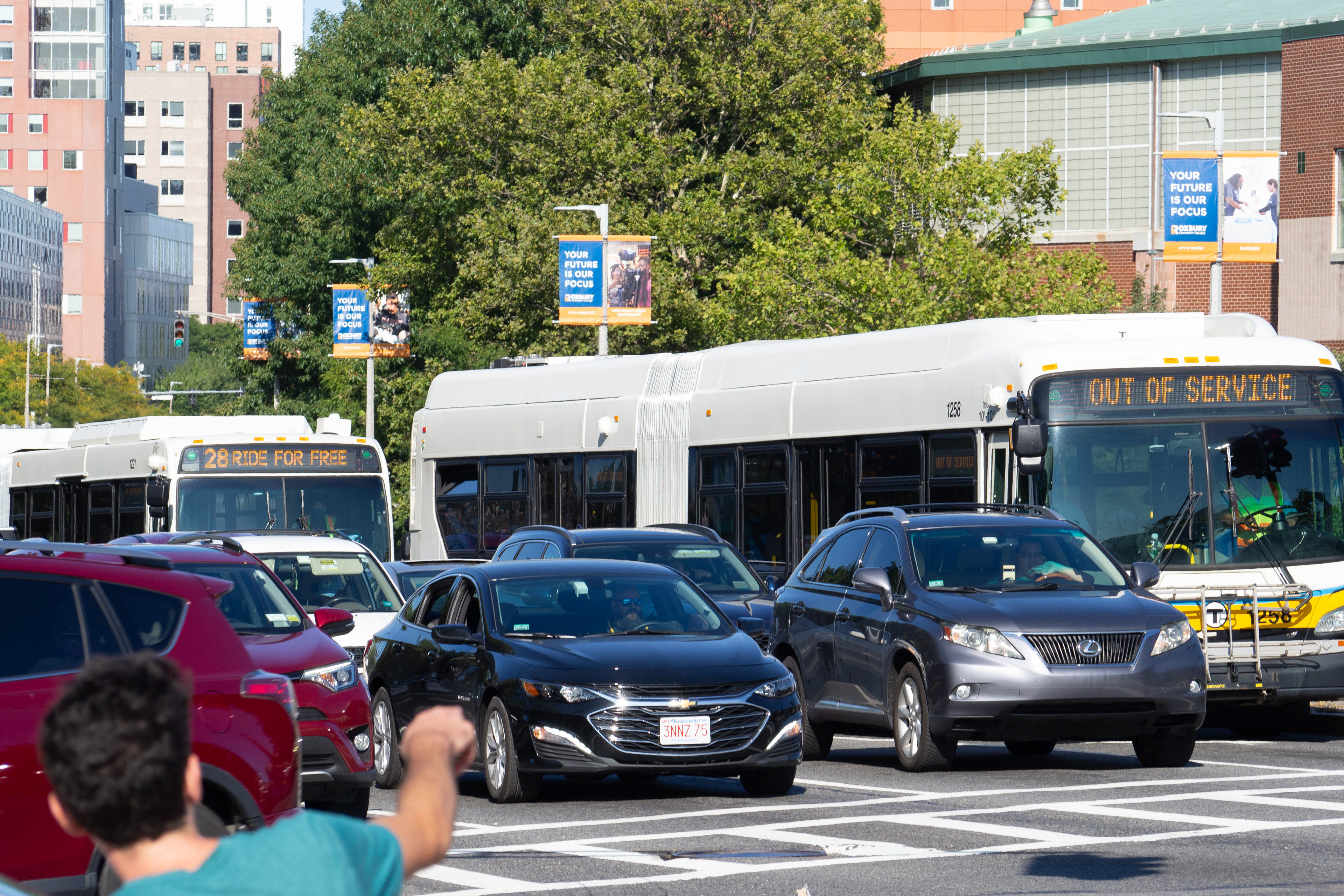
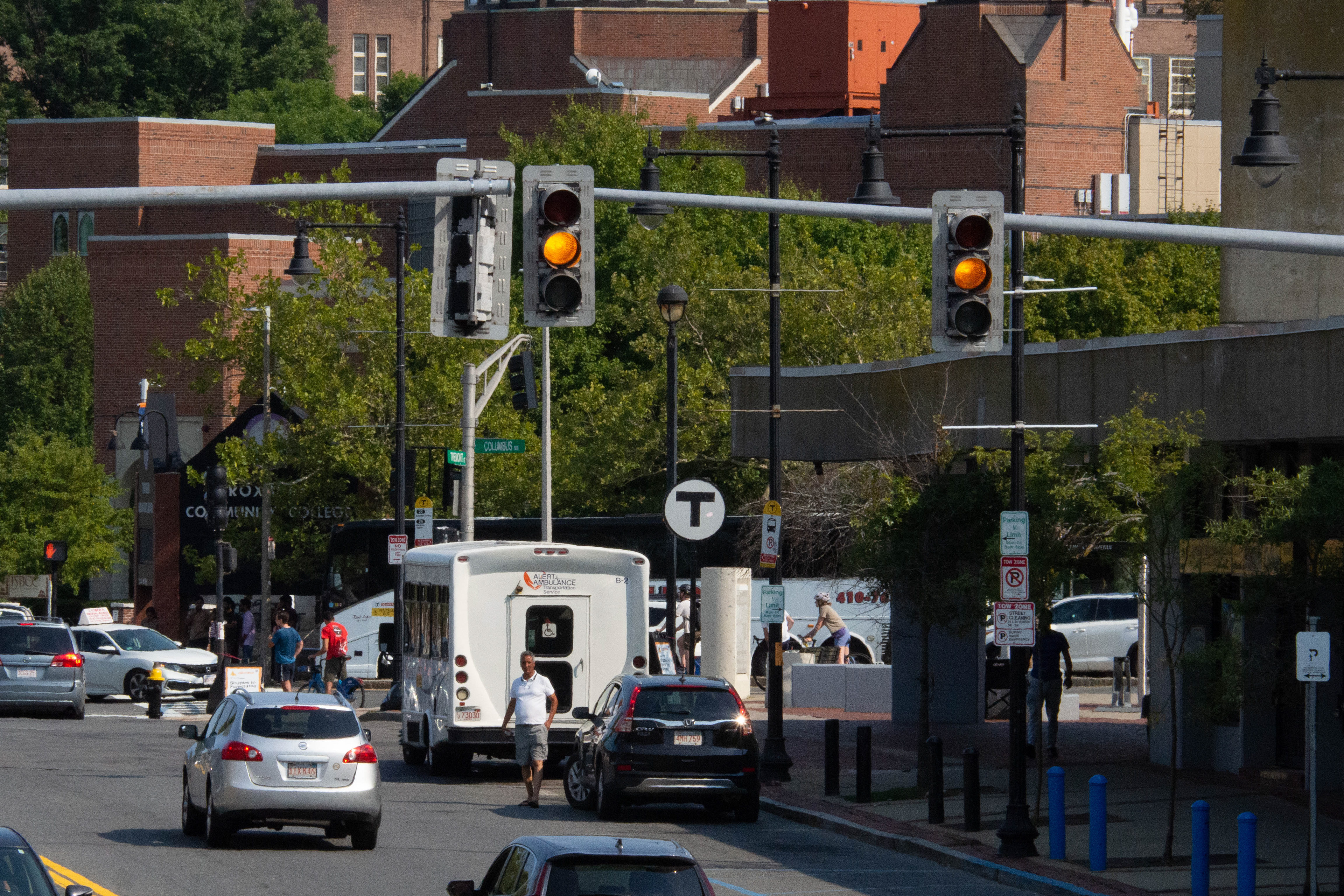
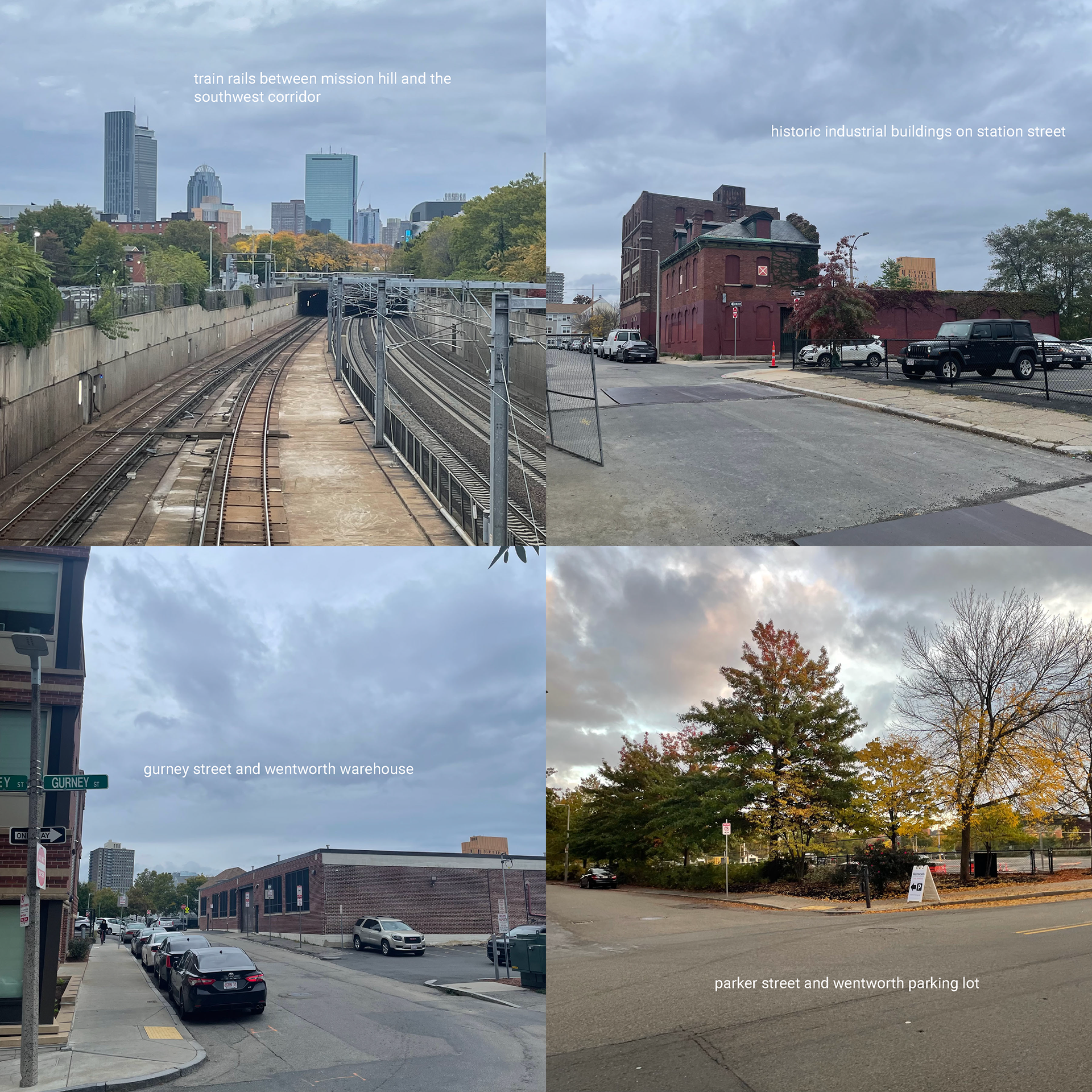
Photos below reveal the site conditions. The main transit-related problems on the site include the busy and hectic intersection at Malcom X Blvd/Tremont St/Columbus Ave, where street names become confusing and pedestrians must wait for a long traffic queue before scrambling to cross. Cars and busses on the six-lane road are oppressive, and crossing feels dangerous. The path from Mission Main and Alice Taylor to Roxbury Crossing is unfriendly and indirect, and bikes and scooters must share the road with cars.
DESIGN TRANSLATION
In the second phase of the project, we began to use our prior research to understand the complexities of the site and to translate that knowledge into a working design solution through the use of an urban design framework plan. Our designs were to include three distinct programmatic elements, one of which needed to be housing.
The site has gone through significant historical changes, and both old and new landmarks scatter the area. Roads and the sunken train tracks are edges that act as barriers towards these landmarks, neglecting their importance in the urban fabric.
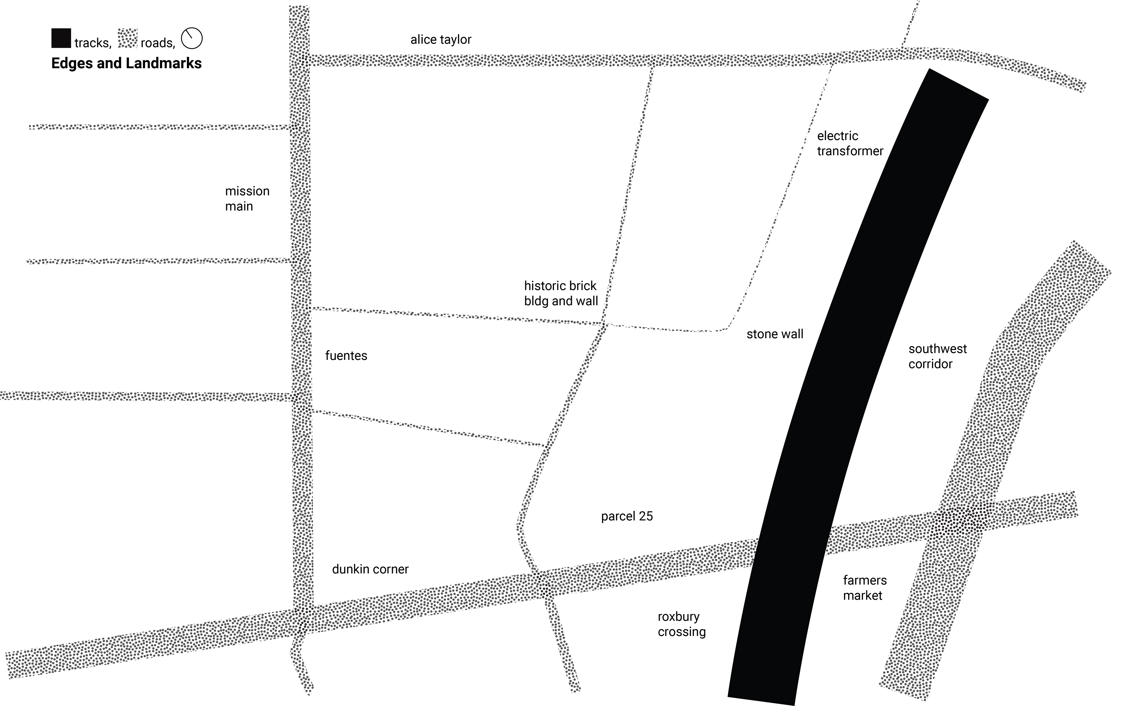
The tracks and roads are similar, in a sense, to shark-infested moats that can only be crossed by way of drawbridge (or, crosswalk). The Parcel 25 elderly housing complex and the Southwest Corridor begin the exclusion of roads through the use of pedestrian-only paths, but that is the extent of it. Much of the site is occupied by low-trafficked roads that only serve the purpose of parking, and is surrounded by high-trafficked roads that box it in.
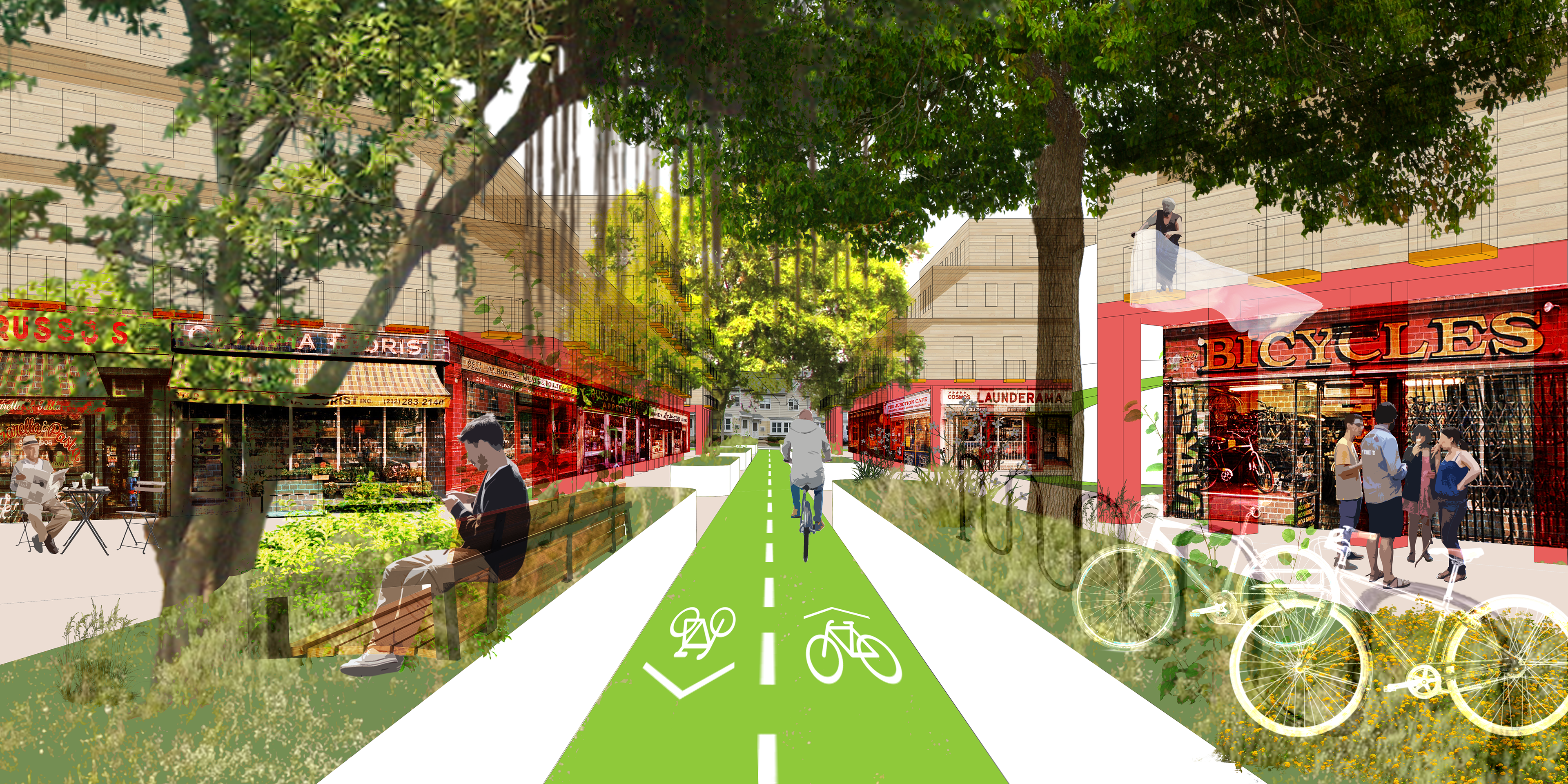
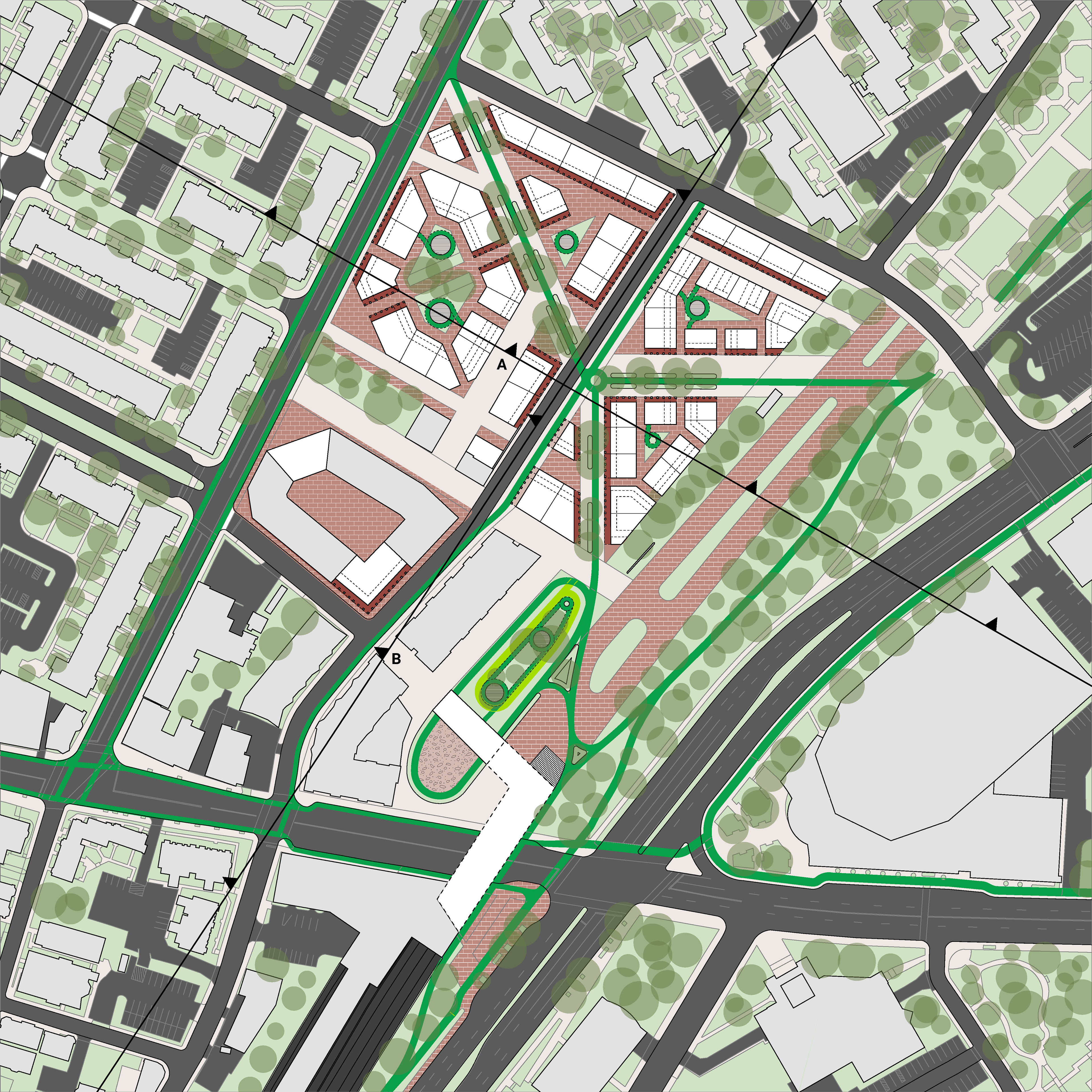
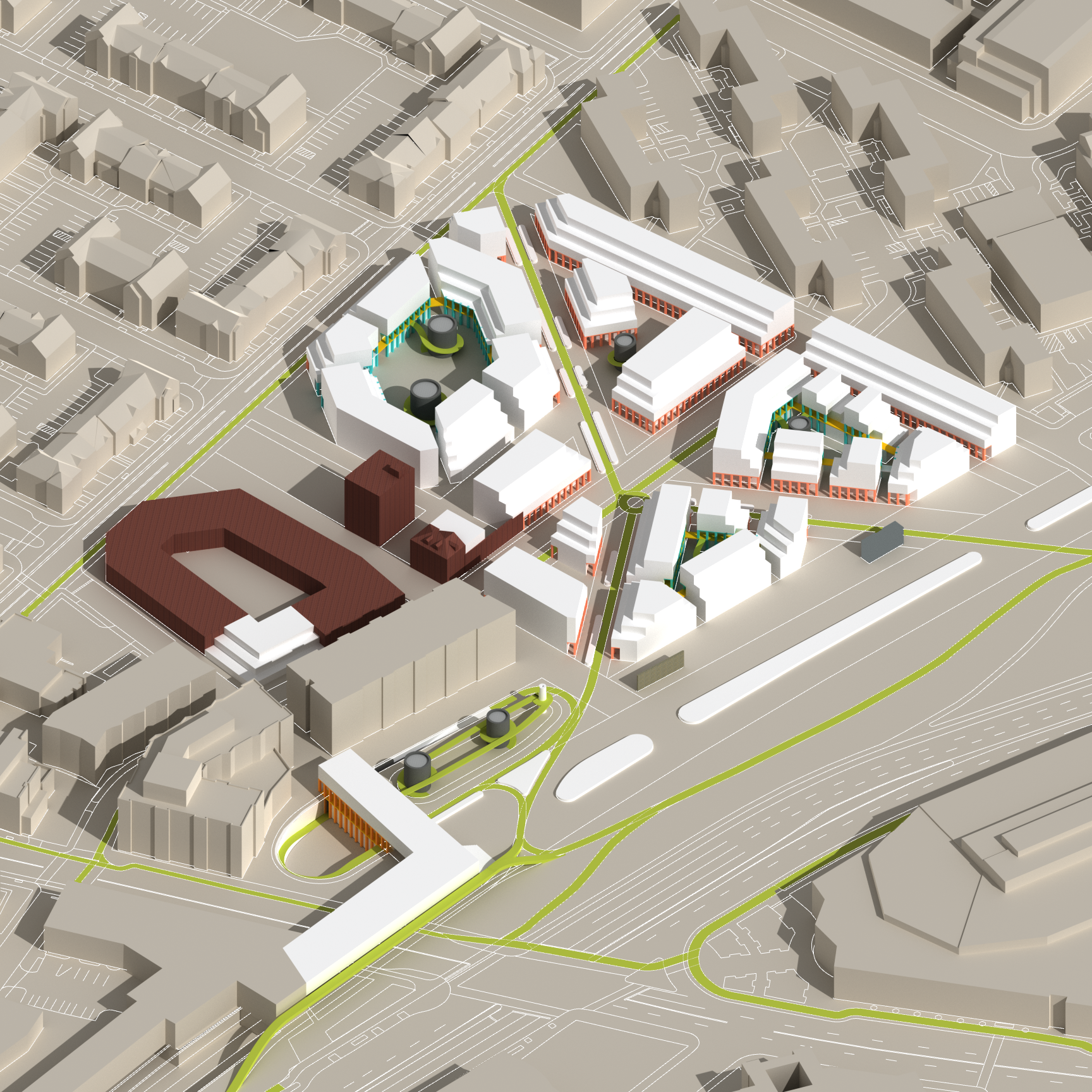
Through transit-oriented design and historic preservation, Mission Crossing would become a mixed-use housing project that catered to the car-less commuter. Commercial opportunities at the ground level would blend with social, accessible living units, creating an essence of liveliness and activity that would encourage travel through the site.
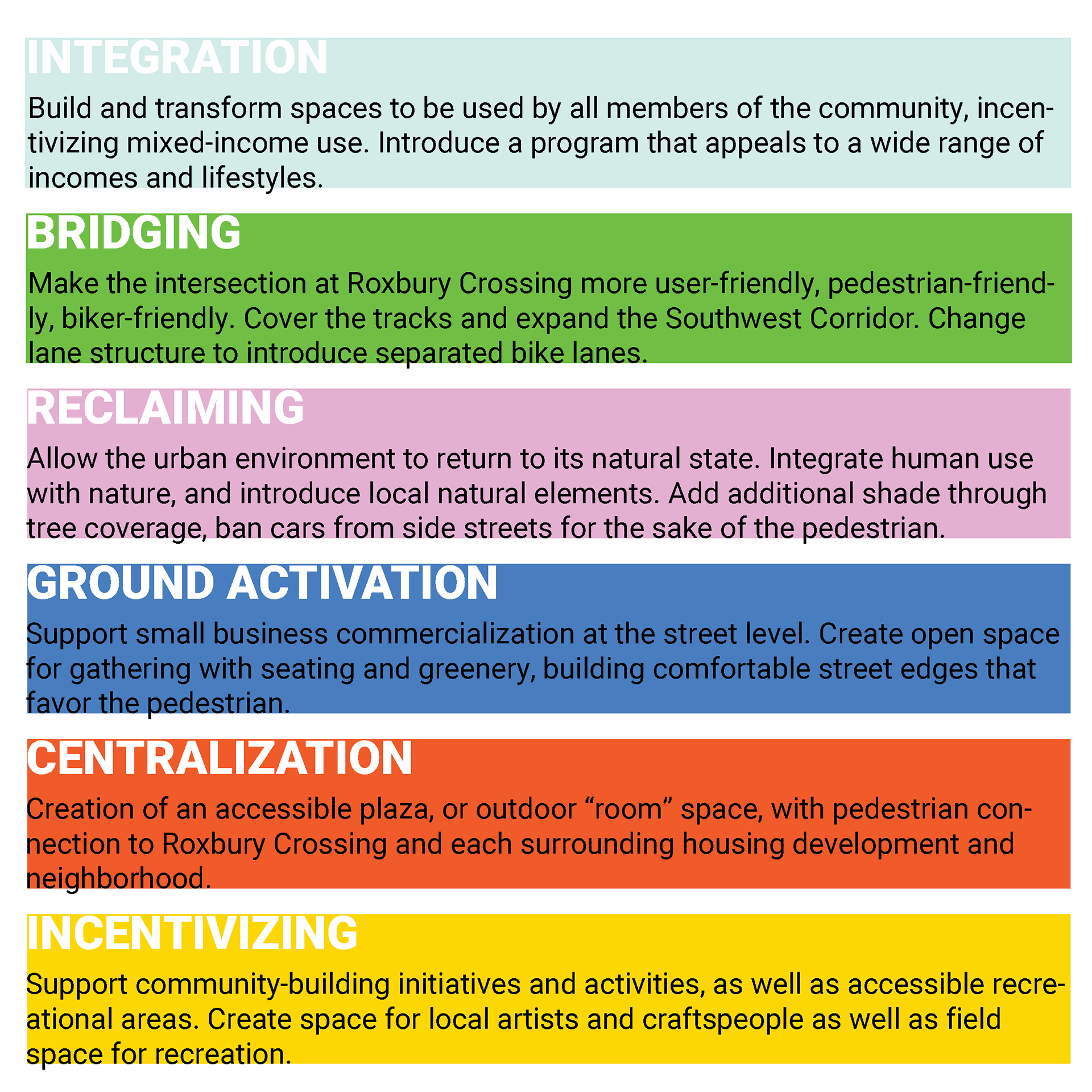
The creation of these six design guidelines was crucial to providing a set of rules for the design itself, highlighting the most important aspects of the development to focus on. The guidelines attempt to create an environment in which all members of the surrounding communities are welcome, encouraging use regardless of social or economic status.
Through Integration, a selected program would be introduced that members of all communities would enjoy using. Expanding on the already-existing farmer's market at Roxbury Crossing, the site was designed to include a flea market in the Wentworth warehouse and a larger, more permanent farmer's market.
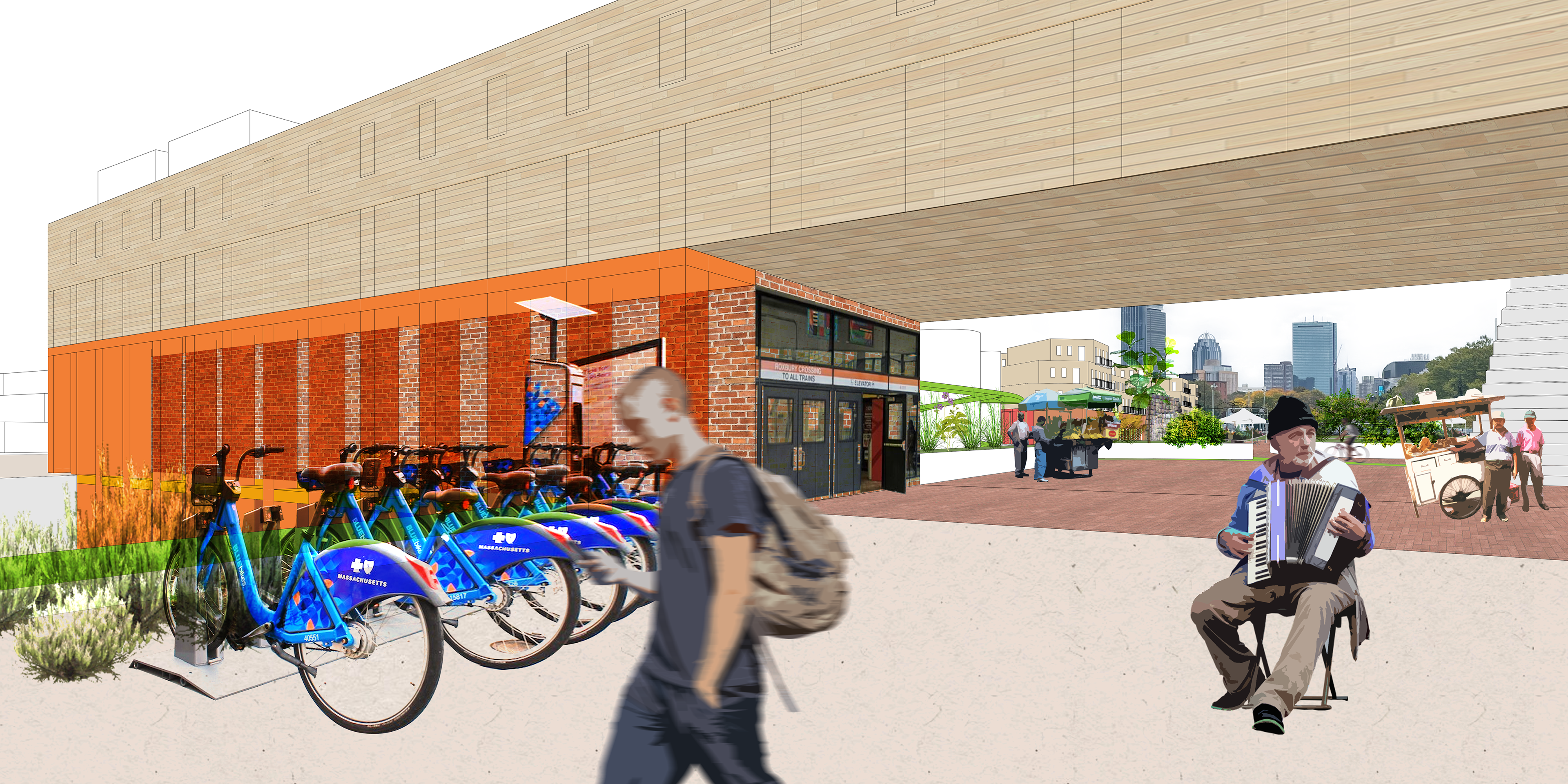
The farmer's market would serve a dual purpose of Bridging, covering the Orange Line tracks and connecting the site directly to the Southwest Corridor. Bike lanes, instead of vehicular roads, make up the majority of circulation through the site. The procession from bike-to-home becomes a main aspect of the project, separating public and private spaces, defining movement, and informing the redesign of Roxbury Crossing (which bridges over Tremont Street).
Introducing urban flora and retail space would satisfy the other guidelines, arranged in a plan with a clear central location and friendly desire-path-following pedestrian streets.
Below, I used artificial intelligence (AI) to conceptualize the design. By inputting images of the site into DALLE-2, the images could be manipulated through text to create entirely new scenes. I ran each of the four images through the generator twice, resulting in the bottom images that paint a very different picture of what the site could be.
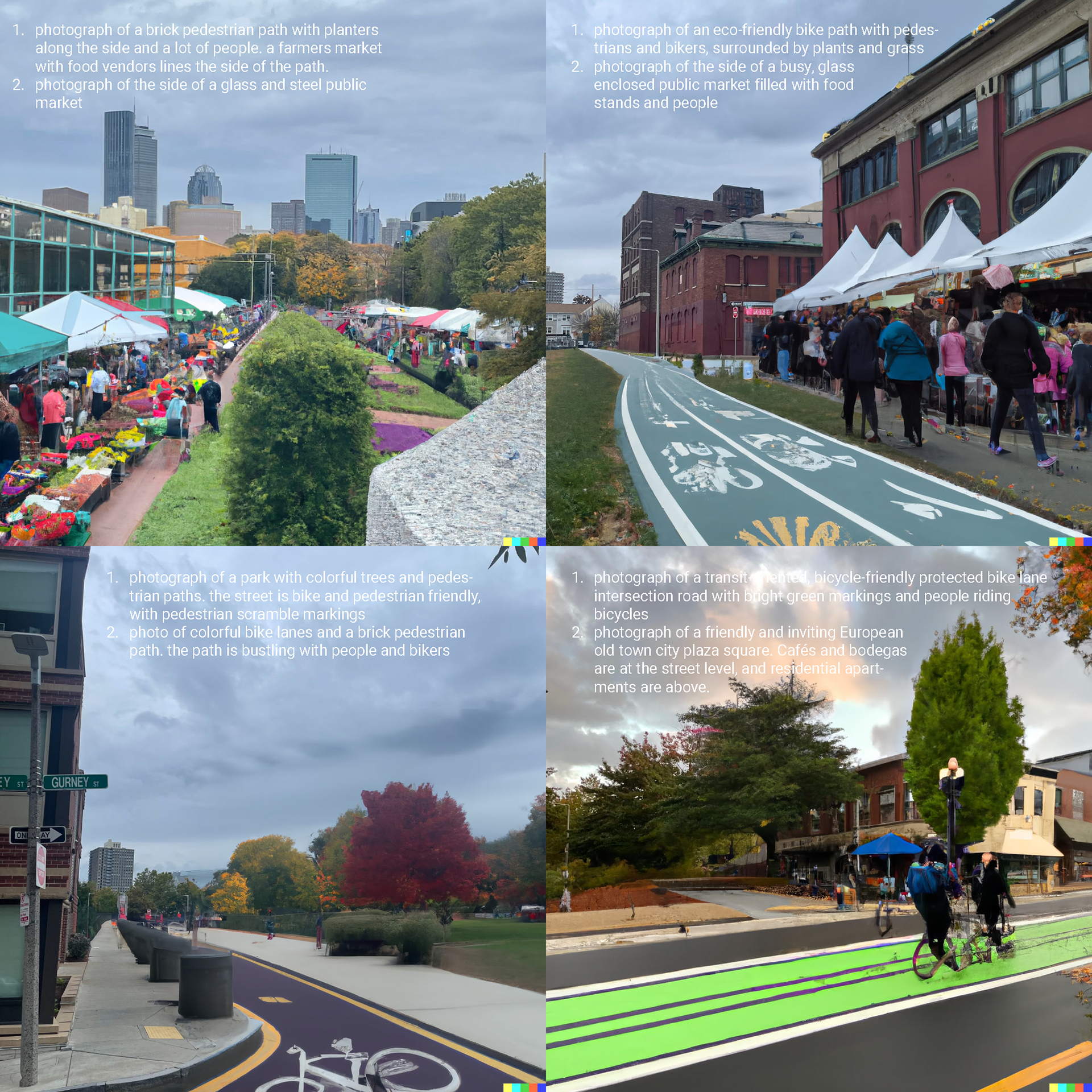
The potential of AI in the field of architecture is limitless, and I am interested in exploring this potential further in future projects. DALLE-2, Midjourney, and other platforms can be used to increase efficiency in conceptualization. The technology is rapidly evolving - brand new AI like ChatGPT can write entire essays, and Point-E can create 3D models based off text input alone. AI will take over the architectural field in the near future, and architects will need to adapt in order to use the powerful technology as a tool in creative design.
Implementation and Urban Detailing
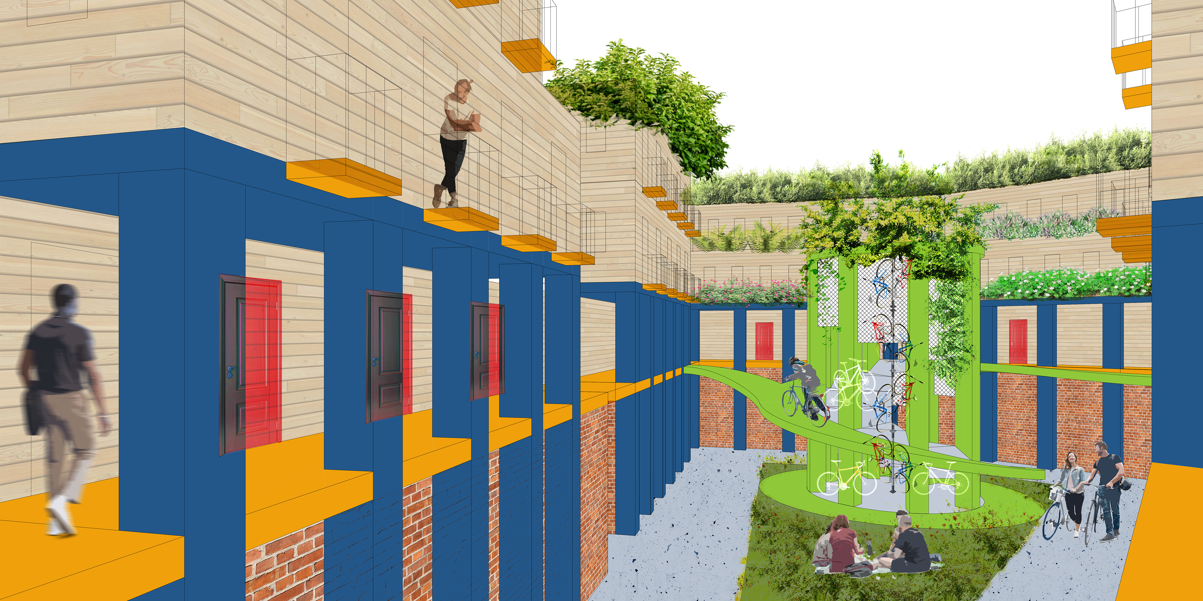
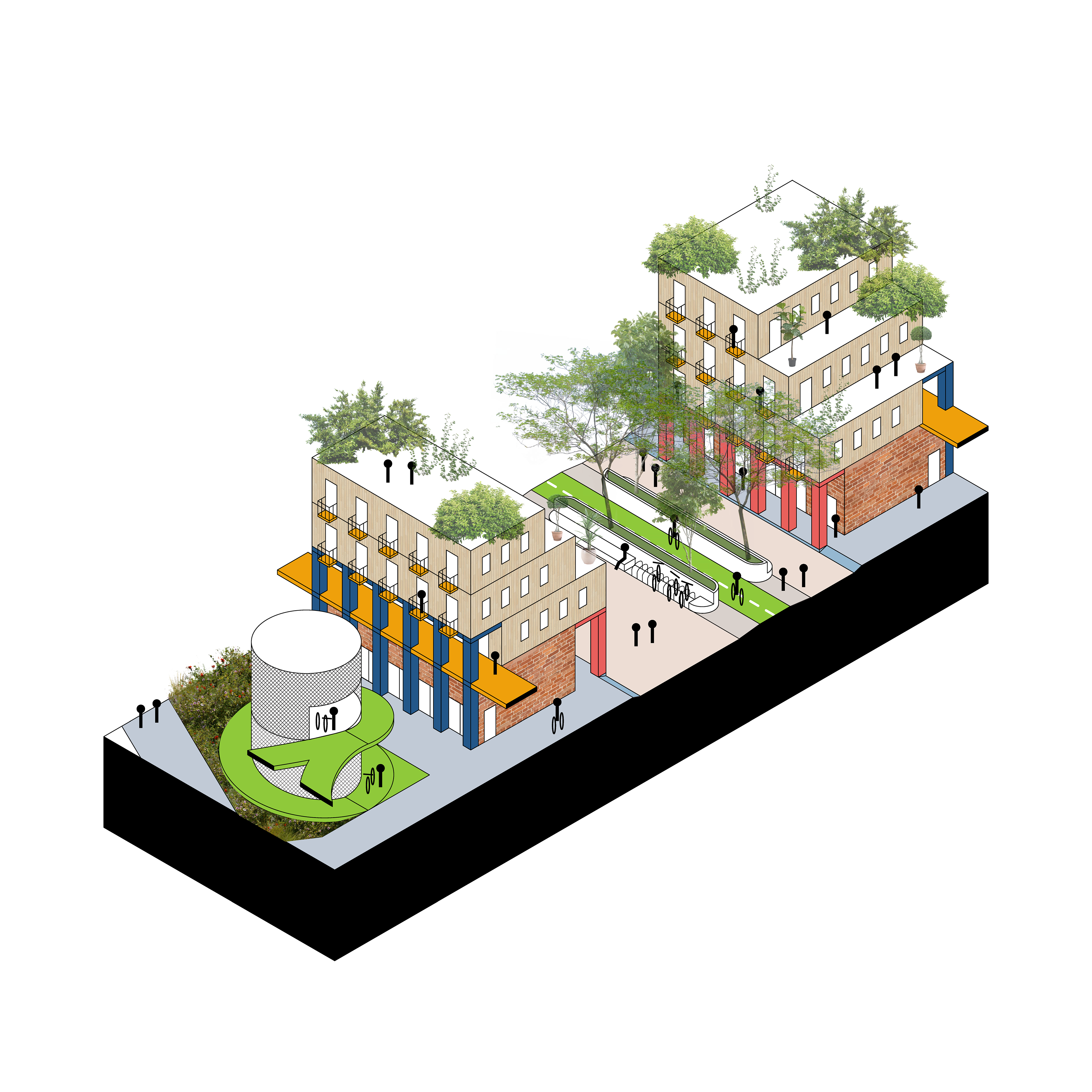
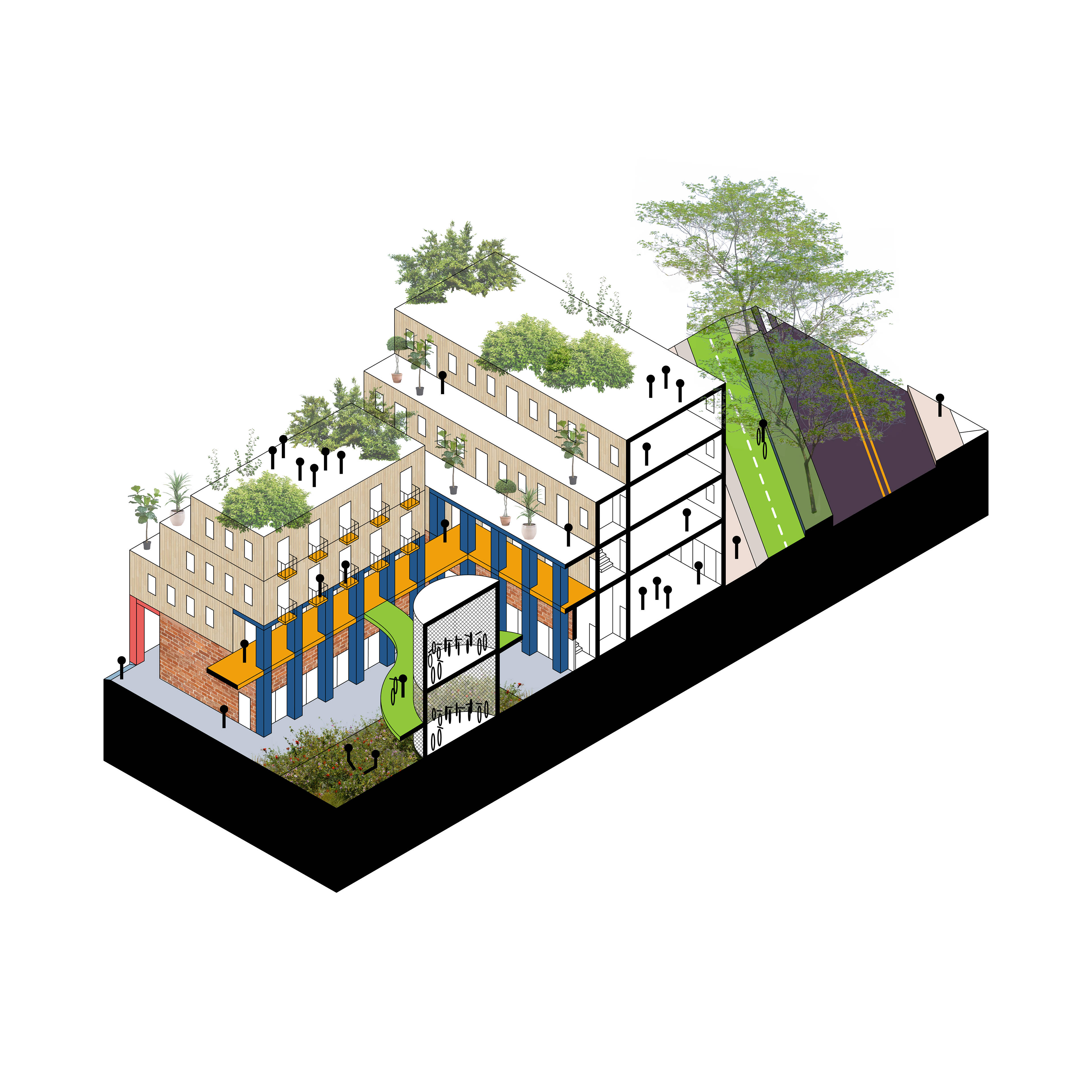
In finalizing the urban design layout, block structures were varied in shape and size in order to promote unique interactions and adhere to pedestrian street conditions. Public and private spaces blend through alleyway and bike connection. Courtyards contain sculptural bike storage units, which allow residents to easily walk up their bike and enter their unit.
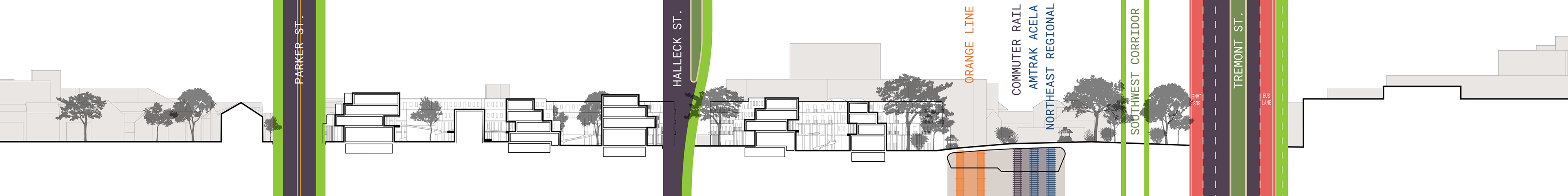
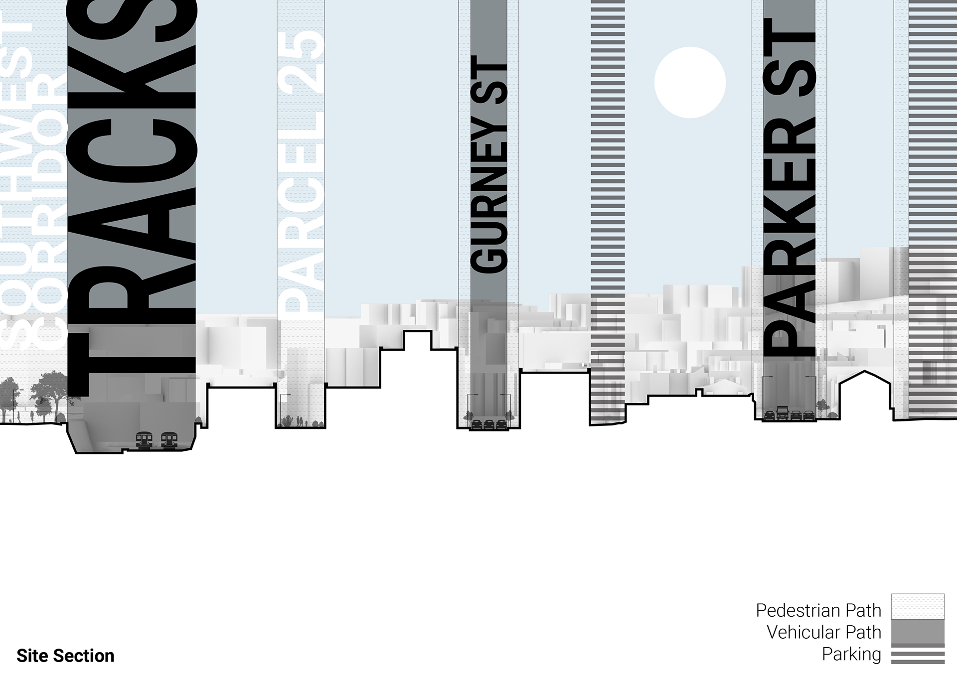
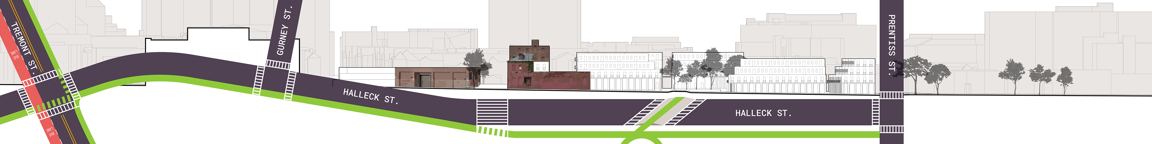
Section A (above) cuts through the three main roads that run parallel to the site - Parker St, Halleck St, and Tremont St. The roads have been redesigned to incorporate bike lanes and bus lanes. The Orange Line, commuter rail, and Amtrak tracks have been covered, and the farmer's market bridges over.
The section also exemplifies the stepped units of the residential blocks, which can only be accessed at the second floor. The units come together like Tetris blocks, in which some are flats, some have two floors, and some have three. The bike ramp and storage leads the resident to a covered circulation path on the second level, which serves to connect the inner courtyards. Below, a simple diagram shows the ground floor retail unit under three interlocking residential units.

Section B (below) cuts along Halleck Street, which runs through the center of the site as the only vehicular street with through access. Other, smaller streets have been removed altogether and replaced with pedestrian roads. Crosswalks have been upgraded and widened, and the raised bike path acts as a speed bump. New construction blends with the historical brick facades at the intersection of Halleck Street and what was previously Station Street.
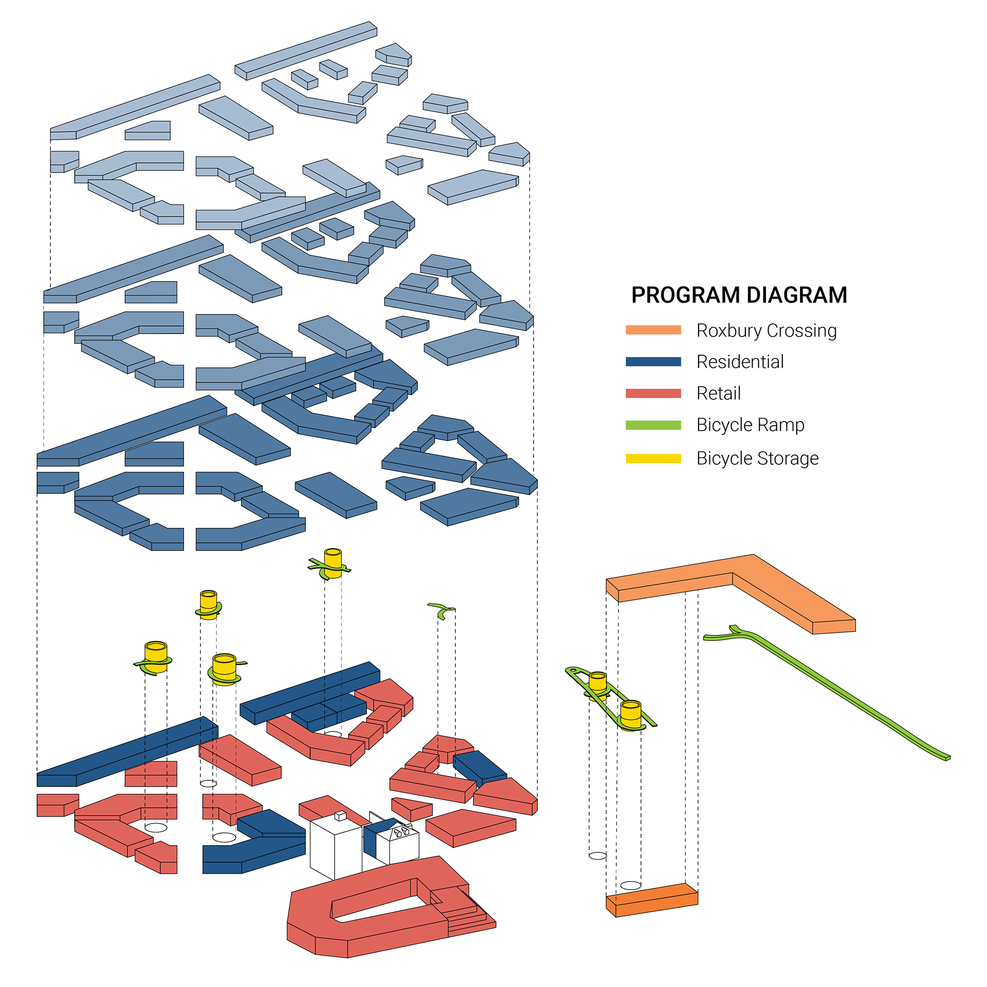
The program diagram below shows the location of the bike storage units, in addition to the ground-floor wheelchair-accessible residential units. Color in the diagram only represents floor level - in reality, units differ in number of floors and each can be accessed on the second floor.
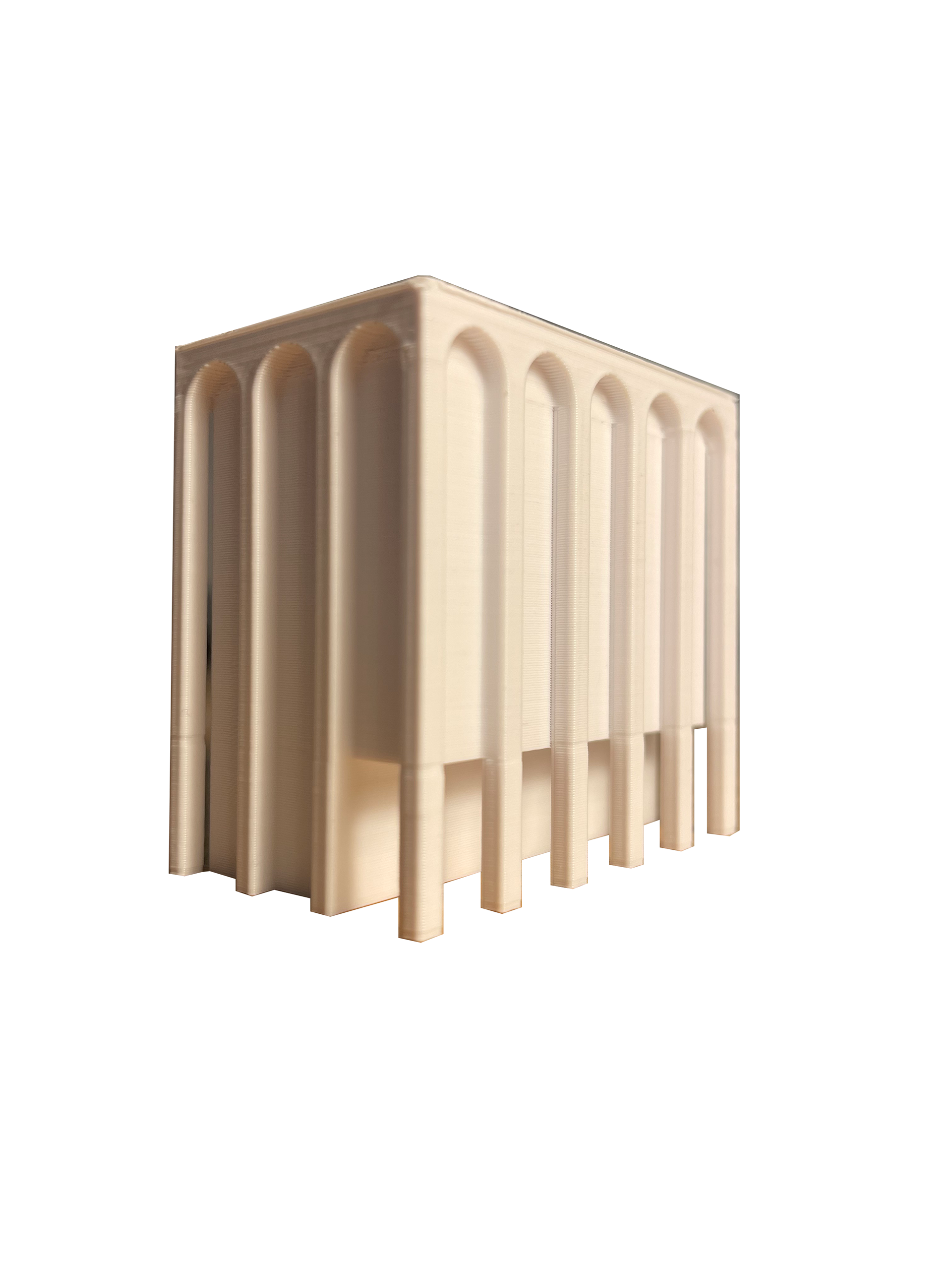
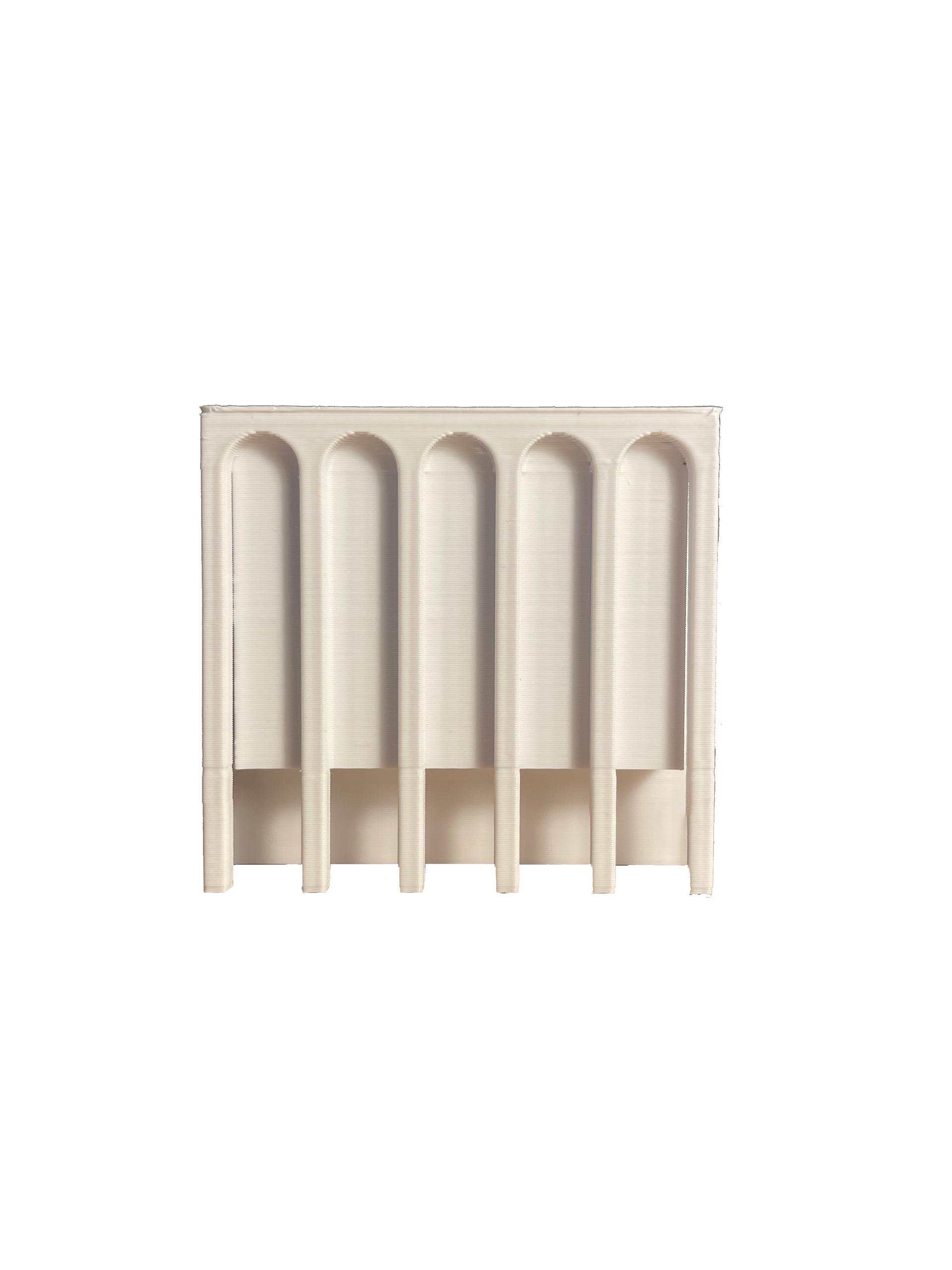
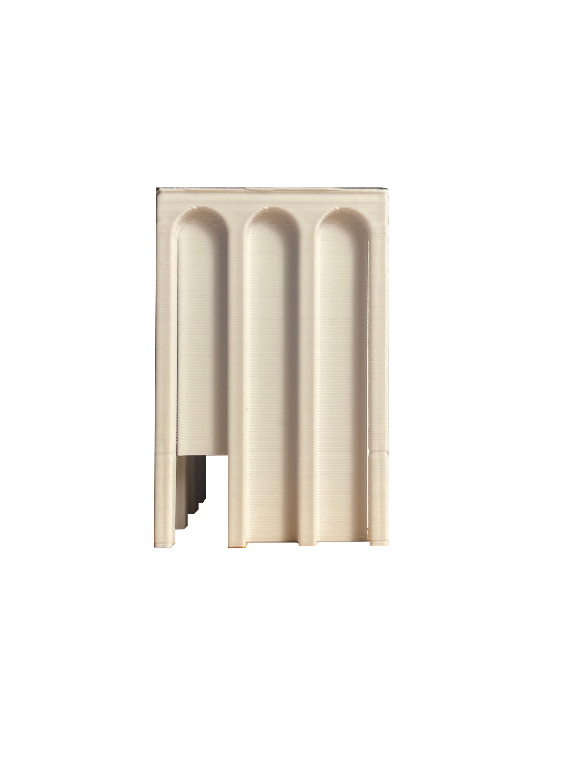
The form of the buildings themselves are inspired by those in Bologna. The Bologna Porticoes make up the streets of the Italian city, effectively enlarging the ground plane and providing for a covered gathering space near the retail. A 3D printed model, printed in the early stages of the design process, in addition to a poured concrete model, reveal this condition.

Studying the urban realm at the transect level is highly beneficial in understanding the details of the project. Materiality comes into play here, and in this project is chosen to differentiate the commercial and the residential. The transition from public passage to private storage is made clear through a changing of material and height. Bike lanes are raised to increase visibility and safety. Residential units, as aforementioned, are stepped at varying directions to boost sunlight for urban flora and promote social interaction. Separating the bike lane and the pedestrian street at the median are seating and temporary bike storage. The porticoed form at the storefronts translates to the second floor circulation in the courtyards, which are more private but follow the same design logic. At the transect level, the procession from the bike lanes to the bike storage in the courtyards and finally to the residential units is made clear.
The following collage renderings show how lively the mixed-use car-less streets become. Balconies overlook the transit lanes as well as the private courtyards. At the Roxbury Crossing extension, a similar design logic follows, serving as a connection to Roxbury itself.